SOUTHERN CALIFORNIA
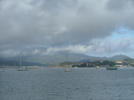
Once we left Bethel Island and the Delta, our focus became getting to San Diego by mid-November at the latest. Our first and only stop back in the San Francisco Bay Area was Richardson Bay, Sausalito. Here's a view looking north into the bay with San Francisco behind us.
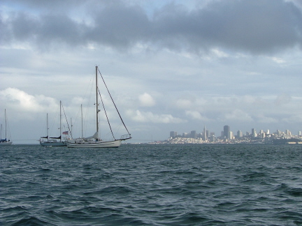
Turning around and looking toward San Francisco, we see the city's skyline, with the Bay Bridge just barely visible behind Kavenga and the other anchored boats.
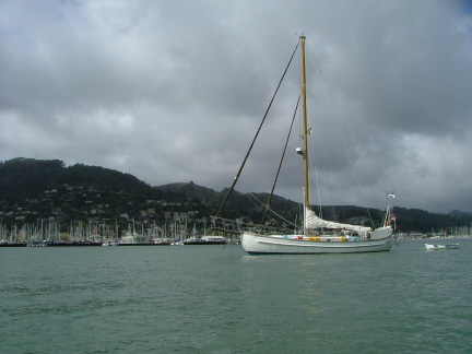
Looking more or less to the west, here's Kavenga in the foreground with the marinas and hills of Sausalito in the background.
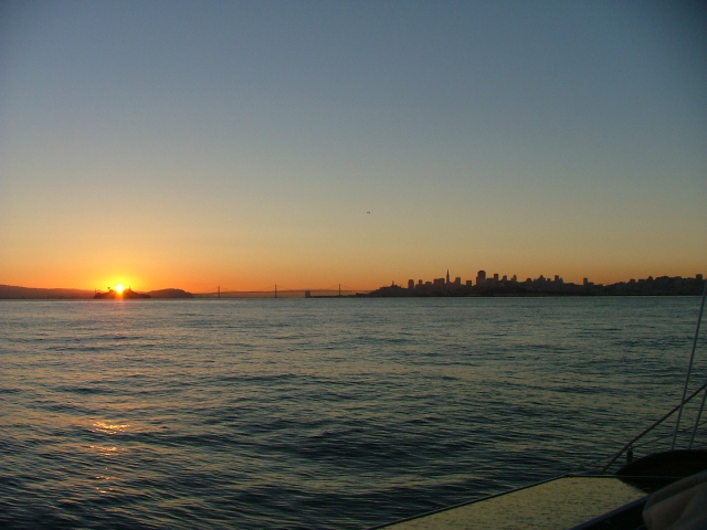
After sitting out a really nasty blow, we had a fair weather window and were provisioned and ready to begin harbor-hopping our way south. Although we were only going the short distance to Half Moon Bay, 25 miles to the south, we left at dawn in order to catch the tides at the Golden Gate and San Francisco bar at the right state of current--high-water slack.
Here you see the sun rising over Alcatraz Island with Yerba Buena Island and the Bay Bridge in the distance beyond. As you can see, we pretty much had the Bay to ourselves.
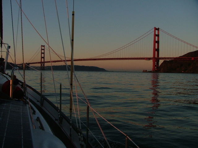
Looking to the other side of the bow, we see the Golden Gate Bridge ahead of us.
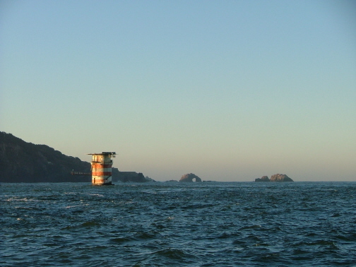
Here's perhaps the most well known navigational aid for ships entering and exiting San Francisco Bay, Mile Rock. Beyond it in the distance is a natural rock arch. It surely has a name, but we don't know what it is.
Note how the small wavelets are peaked like merangue. This is caused by wind opposing the current.
We are looking in the direction we'll be headed. But first we have to get a little further offshore to be a safe distance from the rocks and reefs. The area south of the Golden Gate is notorious for surprising boats with breakers that seem to come from nowhere.
Although it appears quite flat here, there are 12-foot swells just a little further out, so we will not try to cut any corners today.
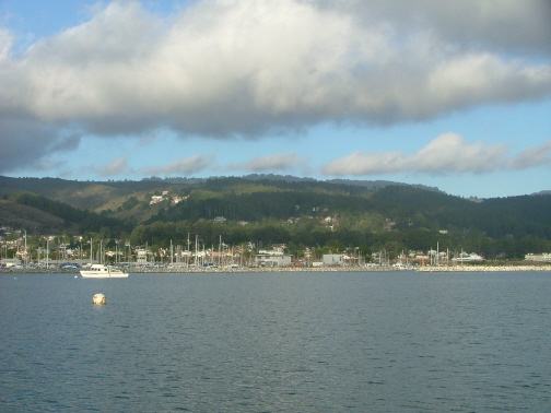
We spent just one night anchored here at Half Moon Bay. It's somewhat surprising that such a nice spot so close to San Francisco is relatively unpopulated compared to Sausalito and the Bay Area in general.
You see the marina behind a breakwater in the distance. However, where we are anchored is also protected by another breakwater that is farther out. We wished we'd been here instead of Sausalito during that "big" blow. We'd have had better protection and less other boats around us to worry about.
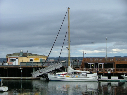
Unlike our last cruise down the coast, we elected to skip Santa Cruz this time and go straight to Monterey. Here we are tied up at the Monterey Peninsula Yacht Club, the brown building on the right.
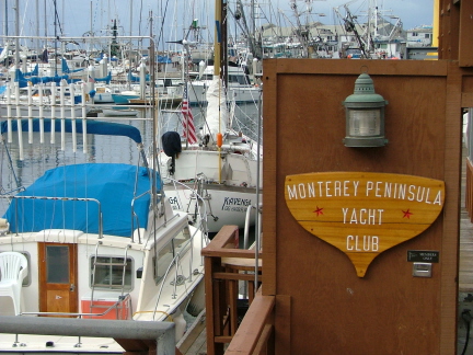
We were invited to the Friday night dinner, which turned out to be excellent and reasonably priced. When we signed the registration book we noticed how thick it was. We flipped back a ways and sure enough, there was our entry from when we had stayed here in 1990. A little bit of immortality felt good.
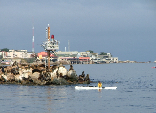
Monterey just may have the most seals per capita of any city on the West Coast. Here's just a tiny sample on the tip of the Monterey Harbor breakwater as we leave Monterey headed for Moro Bay. Part of the Monterey waterfront is in the background.
It seems that, on this trip, we've either had too little wind or too much. The latter was the case after leaving Monterey. We kept reducing sail in order not to arrive at Moro Bay before dawn. Finally we were down to a triple-reefed mainsail only and we were still going too fast. After a brief discussion of alternatives we decided to pass by Moro Bay and continue on to Santa Barbara. To get there before dark the following day, we needed all the speed we could get. The winds held for most of the passage, and we helped out with the engine just to make sure.
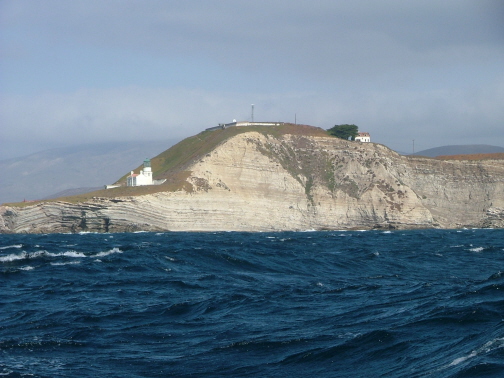
Here we are rounding one of the major turning points on the West Coast, Point Conception. Along with Cape Mendocino and Cape Blanco, this headland is one of the spots that small-boat cruisers worry about as they work their way south or north. These headlands amplify the winds that are forced to curve around them. We were fortunate that the winds we had this morning were only reaching 25 to 30 knots.
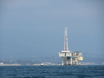
Once around Point Conception, you're in the Santa Barbara Channel which has several of these offshore drilling rigs. The photographer was asleep at his post while we were in Santa Barbara, so this will have to do. That's unfortunate because we think that Santa Barbara is one of the prettiest towns on the coast, especially when seen from offshore. Thus, showing this drilling rig instead is slightly ironic.
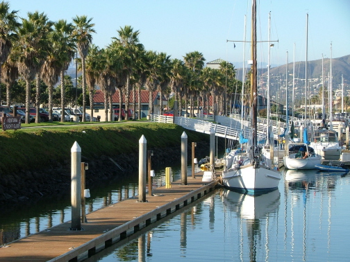
After sitting out a highly unusual, early season rain storm in Santa Barbara, we made the short run to Ventura and received a warm welcome here at the Ventura Yacht Club. This was far and away the nicest, biggest guest dock of any yacht club we have ever stopped at, including our 1990 trip.
Once again it was Friday and we took part in the club's dinner that night, an Oriental buffet that was outstanding. We stayed here for three days and enjoyed every minute of it--well, maybe not the time Steve spent fixing the holding tank pump, but all the rest of it anyway.
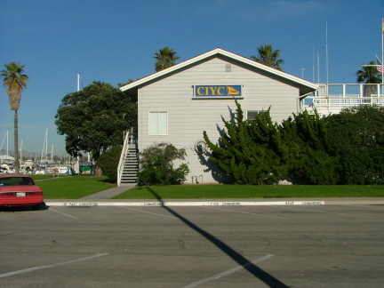
Our next run was even shorter than the 4-hour run from Santa Barbara and it should have therefore been uneventful. However, during the hour that we made the 7-mile run from Ventura to Oxnard, Channel Islands Harbor, a Santa Ana wind came up. We left Ventura with no wind for the first twenty minutes or so. Then the wind came from onshore and we could watch the anemometer (windspeed indicator) climbing minute by minute. By the time we got inside the harbor we had gusts to 40 knots and it took us three attempts and help from a Channel Islands Yacht Club member before we finally got tied up.
Here's a shot of the Channel Islands Yacht Club.
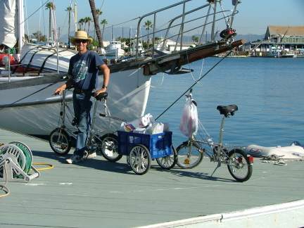
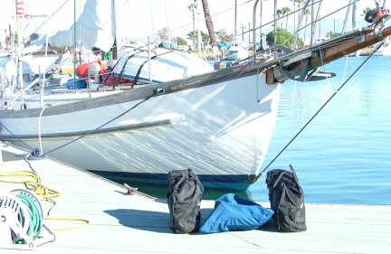
When we're in a city with a supermarket within a reasonable distance we almost always take the opportunity to reprovision. Unless the store is within a block or two, we take the bikes, and if we're planning on getting more than a couple bags worth we also take our cart. Here you see Steve with the cart attached to his stainless-steel Da Hon folding bike, full of groceries after having made a run to the Von's and Ralph's about a mile into town.
Kay's bike has a bag or two on the handlebars.
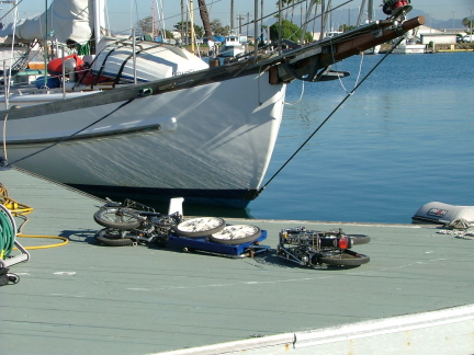
Here's what the bikes and cart look like when they're folded up.....
....and here they are in their bags ready to be stowed on board.
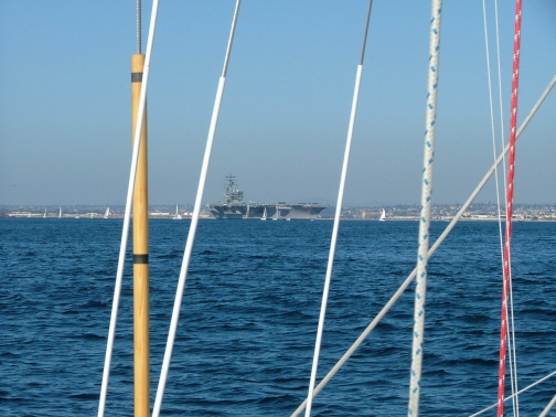
Again the photographer was derelict in his duties during our brief stops at Marina Del Rey and Dana Point. That brings us to San Diego. As if by plan, it just so happened that the USS Ronald Reagan, one of our nuclear aircraft carriers, was heading out to sea from San Diego, just as we were coming in. It was a Saturday and there must have been one hundred or more sailboats coming out at the same time. Whether or not they just happened to be coming out for a sail or whether they were tailing the Reagan, we don't know. But it was a fairly impressive combination.
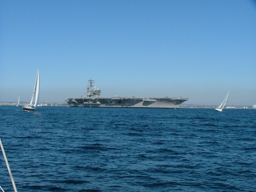
Here's another view. Almost from the time we left Marina Del Rey we were constantly hearing Navy warships on the radio conducting mock battle drills. Although we're not sure, we assume that is probably why the Reagan was headed out.
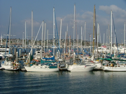
Most southbound cruisers who stop in San Diego wind up at what is known as the Police Dock sooner or later, not because they've been impounded but because it's a "good deal" in terms of moorage cost. We were guests of the nearby Kona Kai Yacht Club for one night and then we moved here to the Police Dock. Our friend and former Gig Harbor neighbor Stan Brice's boat is in the foreground on the left with the teal-colored canvas. Kavenga is kind of lost in the middle but you can pick out her distinctive gold mast.
As this last caption is typed, we sit here ready to head for Mexico tomorrow.
Adios.