TUCSON TO GIG HARBOR
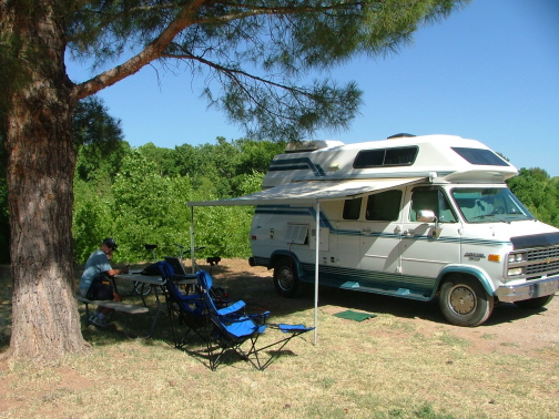
We spent four days in Tucson at the Roadrunner Youth Hostel while we searched for a suitable RV to provide us with transportation, lodging and entertainment for the summer while Kavenga sat drying out in the Sonora Desert.
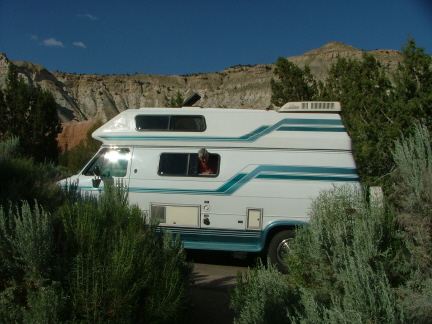
We wound up purchasing this 1993 Chevy Coachman van, the same one we had spotted on the internet two weeks before leaving San Carlos. It has all the 'mod cons': A/C, hot water heater, fridge/freezer, microwave, 2-burner stove, furnace, tub & shower, 2800 watt generator and two double beds-one up, one down. We eventually added a 15" LCD TV.
This is an RV park in Camp Verde, Arizona about half way between Phoenix and Flagstaff. We stayed here three days because they gave us two nights free for listening to their membership sales pitch.
Originally, we had thought we would make a wide swing to the East Coast to visit Steve's cousins and see some of his "ancestral lands." However, the reality of RV gas mileage vis-a-vis current gasoline prices quickly sank in and instead we opted to head due north seeing as many national and state parks as were in our path before it was time to hang a left for Gig Harbor.
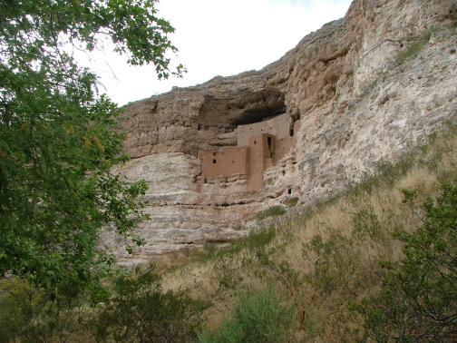
Montezuma's Castle National Monument is very near the Camp Verde RV Park.
This 1,200-year-old pueblo turned out not to be Montezuma's summer residence, contrary to what the first non-native discoverer believed.
The people who lived here were called the Sinagua, which would seem to suggest (in Spanish) that they somehow lived without water. However, a rather large river flows very nearby the foot of these cliffs.
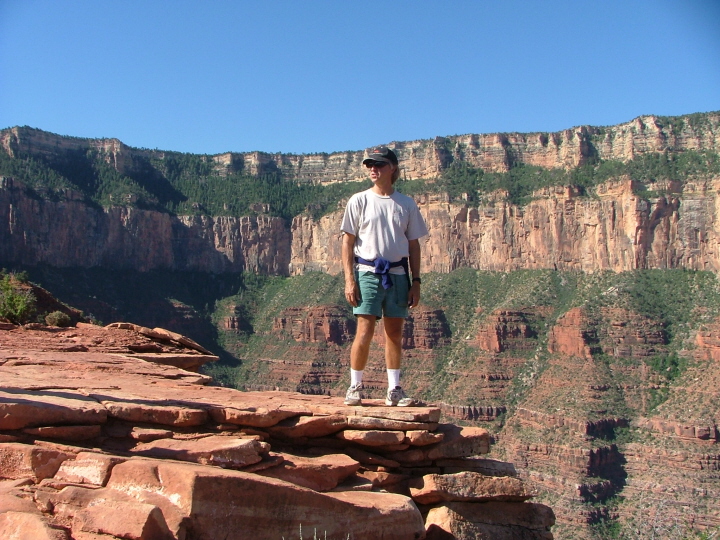
We took dozens of pictures during our five-day stay at the South Rim of the Grand Canyon. It is difficult to get a shot, other than from the air, that does it justice.
So rather than use one of our many attempts to capture the immense width and depth of the canyon, we instead provide this shot of Steve, taken about 1,500 feet below the rim on one of the main trails that leads to the bottom.
We turned around at a point called Cedar Ridge, as we were not equipped for the hike to Phantom Ranch at the bottom and back to the top.
It is amazing to see 1.6 billion years of geologic history laid bare to the naked eye; to think of the incredibly slow processes of sedimentation, uplift and erosion that were required to create these humbling vistas.
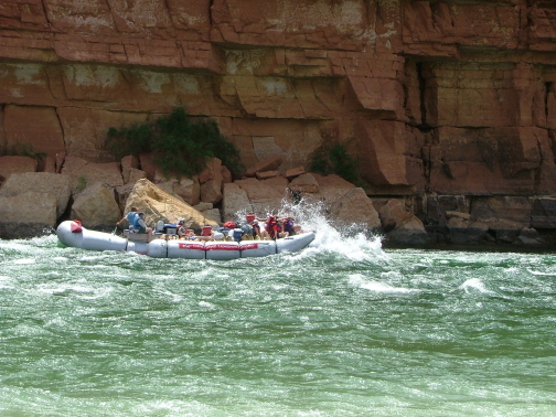
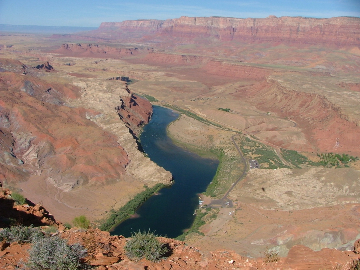
A place called Lee's Ferry is at the head of the Grand Canyon, and it is here that the 18-day raft trips through the canyon begin.
If you can pick out the two people with gray baseball caps in the right, front section of the raft, good for you. They are not us.
Thanks to the silt-trapping Glen Canyon Dam, just upstream, the Colorado River no longer has its distinctive turbulent red color.
The air temperature here was 104 F; the water temperature was 46 F. It was painful just to stand in water up to your knees.
We hiked up Spencer Trail to get this view of Lee's Ferry.
You can see the raft launching ramp at the lower, middle center.
On the upper right is the beginning of the Vermillion Cliffs.
It was here that Mormon settlers built a small ferry that allowed them access between Arizona and Utah.
The Lee's Ferry State Park where we stayed in the van is at the end of the small strip of green just where the river bends out of sight.
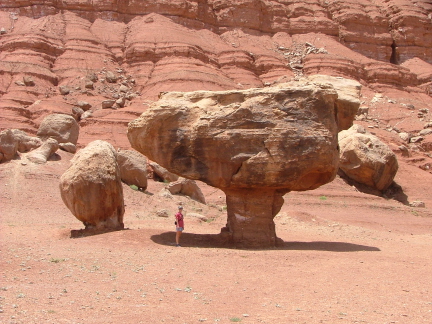
Kay stands near one of the many balanced rocks near Lee's Ferry and the Navajo Bridge.
They are created when boulders roll down from the cliffs in the background. Over time, erosion removes the softer rock and soil around the boulder, leaving it standing on a pedestal.
We followed the Vermillion Cliffs west and north. We stopped for the night at Fredonia, Arizona before continuing on to Zion National Park the next morning.
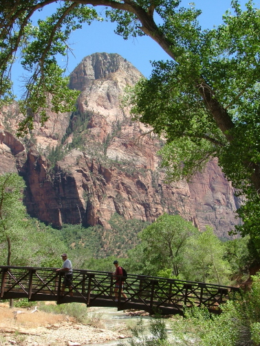
Unlike the Grand Canyon and Bryce Canyon, you enter Zion from the bottom rather than the top. We met a man on one of the shuttle buses who said he preferred that and that walking near the edge of the Grand Canyon had made him too uncomfortable. He is probably not alone.
So, if you share his concern, Zion is the canyon park for you. Again, it is impossible to find one photo that does it justice (and we're trying to keep the size of our website reasonable.)
Here, Kay is traversing one of the foot bridges that cross the river that runs through Zion.
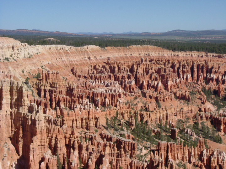
The next day, it was on to Bryce Canyon.
The differential erosion of the layers of sedimentary rock creates many unusual natural sculptures.
This view is simply one of the larger areas of the park. There are hundreds of other amazing forms to be seen and experienced.
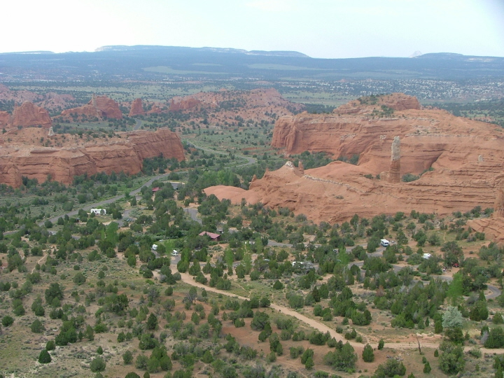
This was our campsite at Kodachrome Basin State Park, Utah. No particular reason for the photo other than it was a pretty campground and there were lots of Chukars. Very cute birds.
We took a short hike out of Kodachrome Basin called Eagles View. There was a sign at the trailhead saying that the trail was damaged and to proceed at your own risk or words to that effect. Steve reasoned that it couldn't be too bad since, in national parks, if there is even the slightest danger, they close the trail.
Kay wisely stopped and waited once the trail began to narrow and grow steeper, about half way down in this view.
Steve continued on until he reached a point were the trail disintegrated to small foot-holds in the side of the loose shale slope. He soon realized that going down was substantially more difficult than going up. He had to study each step for several seconds before moving.
A ranger at the next park we visited knew the trail and was astounded to hear that it was open.
Steve did manage to get a photo of the Kodachrome Basin Campground once he got back to a safer section of the trail.
There were numerous chimney rocks in the basis, one of which can be seen at right center.
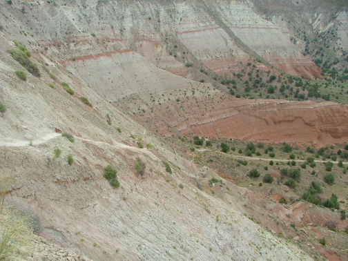
After spending one night at Escalante Petrified Forest State Park, we continued on to Capitol Reefs National Monument.
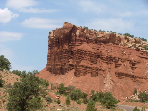
This rock formation is called The Pharaohs for its resemblance to the stone sculptures of the pharaohs of Egypt.
Capitol Reefs N.M. is not as well known as the other big parks in Utah and Arizona but the scenery is on par and the main campground is very nice.
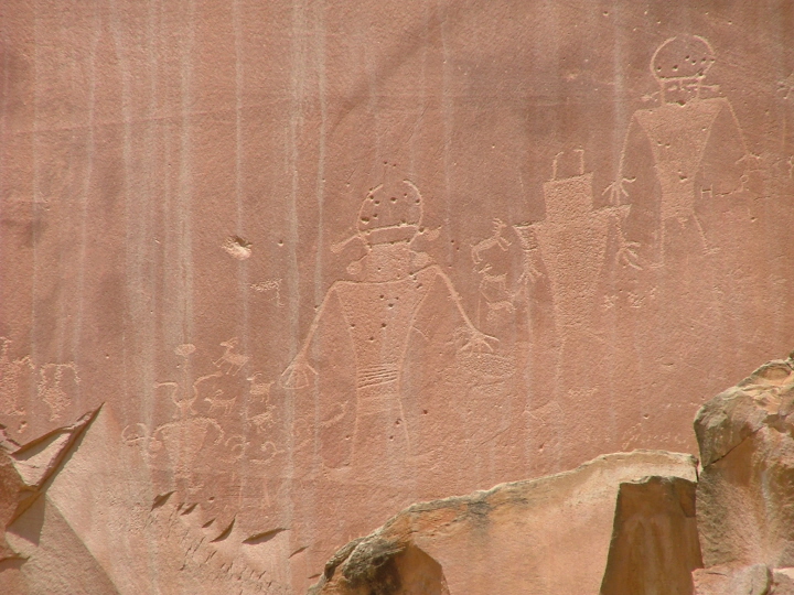
Just outside the Capitol Reefs park entrance is this historic site containing numerous petroglyphs.
Although a fair amount is known about the culture of the people who lived here over one thousand years ago, not much has been deciphered as to the meaning of these cliff drawings they left behind.
The pock marks are bullet holes made by vandals.
Some of the glyphs have been lost due to erosion and rock falls.
The native artists could scarcely have imagined the day would come when thousands of passersby would take away millions of images such as this one to save, share and study. Not a bad legacy.

This was our "campsite" at Goblin Valley State Park in south central Utah.
Aside from having our own gazebo with picnic table, the new asphalt slab was large enough for two Class A RVs (the big bus types).
Not many people know about Goblin Valley. Most of the campers are Utah Boy Scouts or boaters on their way from Salt Lake City to do some skiing and fishing at Glen Canyon.
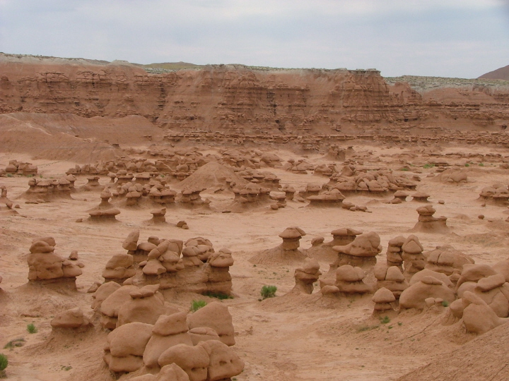
We learned about Goblin Valley from the space spoof movie, "Galaxy Quest". It looked so bizarre in the movie, we just had to see it for ourselves.
It was originally named Mushroom Valley--no explanation should be required.
The odd forms are created when soft, crumbly rock is eroded out from beneath stronger, denser rock.
The actors Tim Allen, Sigourney Weaver, Alan Rickman, Sam Rockwell and Tony Shaloub spent several hot days filming here. It was worth it. Rent Galaxy Quest if you haven't already seen it. It's a hoot.
We made our longest day's drive from Goblin Valley to Rexburg, in north central Idaho where we stayed overnight in the local Walmart Parking lot. Walmart welcomes RV'ers to use their lot as long as they park on the outer fringe and leave things the way they found them.
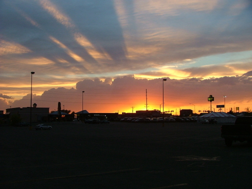
We just threw in this sunset shot to show that you can get interesting photos in even the most mundane locales.
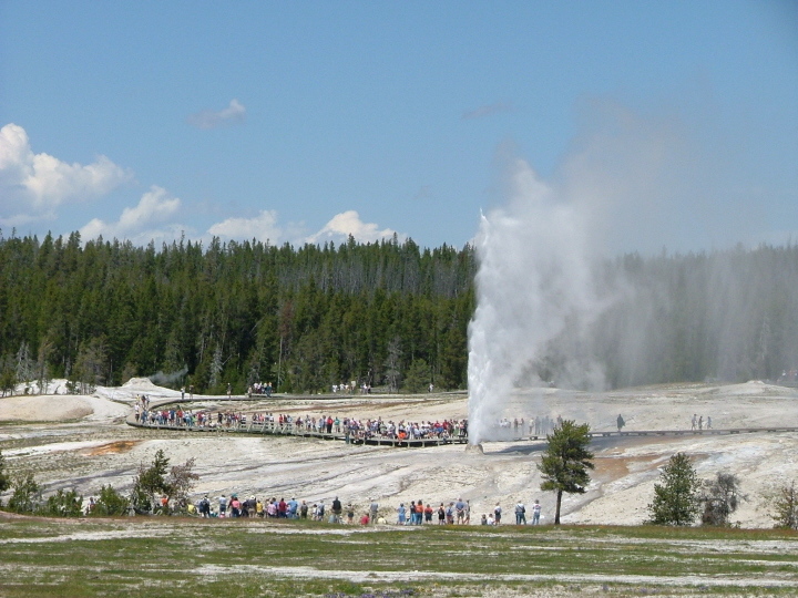
We hesitate to include a geyser photo from Yellowstone, since there's hardly anyone left on the planet who hasn't already seen several. Out of the several we took, rather than Old Faithful, here's one of Beehive Geyser, less predictable and less frequent than Old Faithful, but every bit as spectacular.
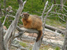
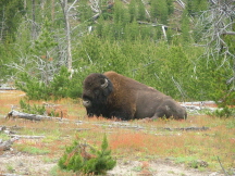
In addition to the geysers, there's a lot of wildlife to be seen. Here's some of what we observed. On the left, a marmot comfortably resting on a limb at Artist's Paintpots area; a bull bison that Kay almost literally ran into as she was running one of the many park trails;
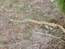
and at Mammoth Hot Springs, this 6-foot gopher snake.
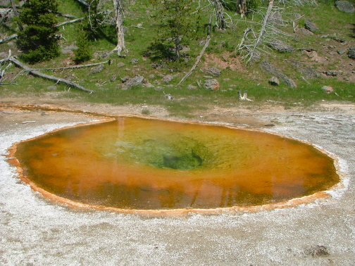
From Yellowstone, we drove almost straight home to Gig Harbor, with a brief overnight stop in Moses Lake, Washington. We end our tour of parks with one last image from Yellowstone.
It's a spring whose name we don't recall. We just like it because of its colors, its symmetry and its contemplative peacefulness.