OREGON
The Oregon segment of our cruise was taken at a liesurely pace to say the least, due mostly to rough weather along the coast. Consequently, we have more pictures per mile than we had for Washington. Here's just a few of them.
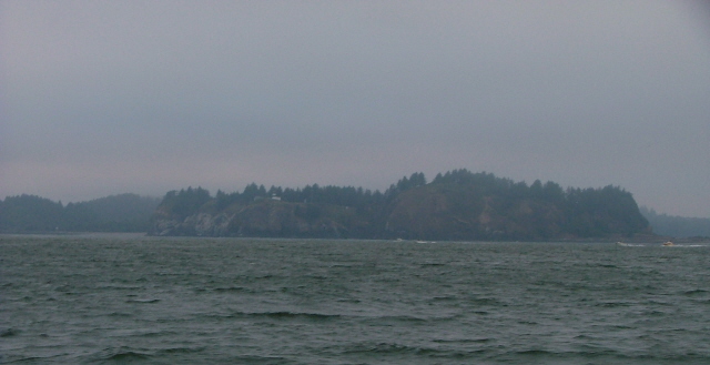
Our first indication that we were approaching the Columbia River from offshore came very early in the morning when we saw the flashing lights from the Cape Disappointment Lighthouse from about 20 miles out. Here it is on the far side of the river, as we pass by. It's actually in Washington, but we include it here since it was our landfall en route to Astoria, up river.
It took us two and a half hours to wind our way upriver to West Basin Marina in Astoria, Oregon. After refueling we were assigned to a slip near the end of E-Dock, which was, as you can see here, very near the fort-like entrance to the marina. It was fine when the winds were calm as they are in this shot. However, it became a little bouncy when the winds piped up.
The evening of the following day must have been race night for the the Astoria Yacht Club as we watched a handful of sailboats depart the marina in 25 to 35 knots of wind blowing upriver. In the foreground is the fuel dock, just inside the steel breakwater.
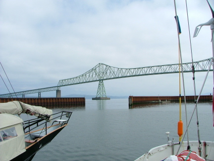
The day after we arrived we caught a ride to the east end of town and walked back to the boat. The West Basin Marina where Kavenga is moored is almost underneath the very long bridge that spans the Columbia River seen here looking downriver.
We had a fast, rolly, overnight passage from Astoria to Newport, Oregon. One doesn't need to go far upriver here to reach the marina. It's just beyond the Highway 101 bridge over the Yaquina River. You've just cleared the bar and passed between the jetties and it's already time to pass under the bridge and make the turn into the marina.
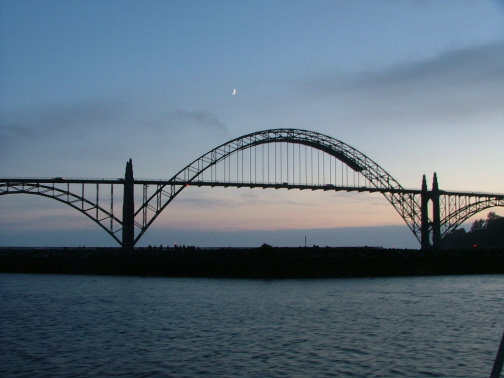
During a couple of the many days we spent at South Beach Marina, we were treated to these evening twilight views of the crescent moon over the bridge. The jetty that protects the marina is in the foreground.
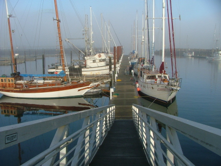
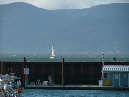
Here's J-Dock, the transient dock, at South Beach Marina, Newport. It was barely half full when we arrived but as the weather continued to be somewhat rough, fewer boats were leaving as more arrived.
This was our second visit by sea to Newport, so we were aware of how tricky it can be to maneuver inside when the wind and current get cranked up. A couple of the boats, side-tied to the north side of the dock, learned the hard way when they were hit by boats trying to get to the fuel dock, just out of sight to the right.
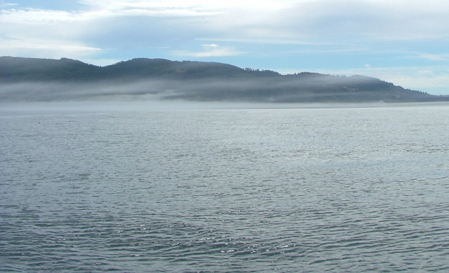
This shot was taken in the morning when it's the calmest. You can also see the persisitent fog bank that is just hiding the bridge. If you look carefully you might just see the top of it.
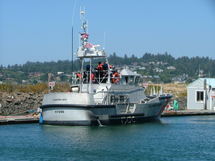
If you ever spend any time in a boat along the West Coast of North America, you're very likely to see one of these. This is a Coast Guard 47-foot motor whaleboat. They are watertight, virtually unsinkable and designed to be able to survive repeated capsizes in heavy surf. Although they have an enclosed pilot house we were told they rarely use it, preferring to run the boat from its flybridge. They are powered by two huge Detroit Diesel engines. This one is "shooting landings" after refueling. In other words they were practing making approaches on the dock. Although it may not look it in this shot, the wind was actually gusting to 20 knots. Last time we were in Newport, almost every cleat on the fuel dock had at least one of its horns broken off, a testament to how difficult the landings here can be. We were glad we had plenty of fuel and didn't need to top off.
We later got a tour of one these boats in Winchester Bay.
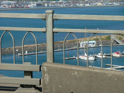
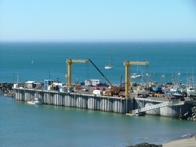
I had hoped to get a better shot of Kavenga from theYaquina River Bridge but construction on the upriver side prevented it. So please excuse this shot through the railing, but it gives you an idea of where we and the guest dock are in relation to the fuel dock beyond. This shot was taken before the guest dock started to fill up.
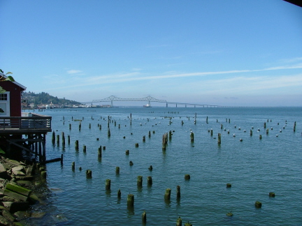
Beyond the jetty behind the fuel dock is Yaquina Bay, which is really just a wide stretch of the Yaquina River. The bayfront tourist section of town and the commercial marina can just be seen at the top of the picture on the other side of the river.
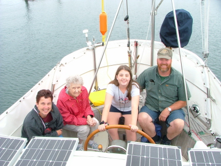
While in Newport we were paid a visit by Steve's Aunt Jean, her daughter Denise, along with Denise's daughter Katie, and husband Kim. They drove over from Steve's hometown of Salem for the day.
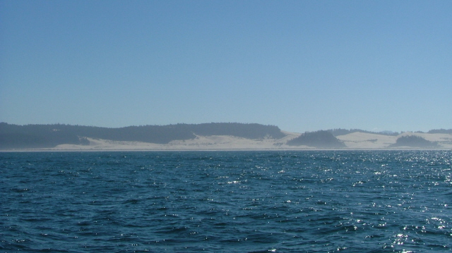
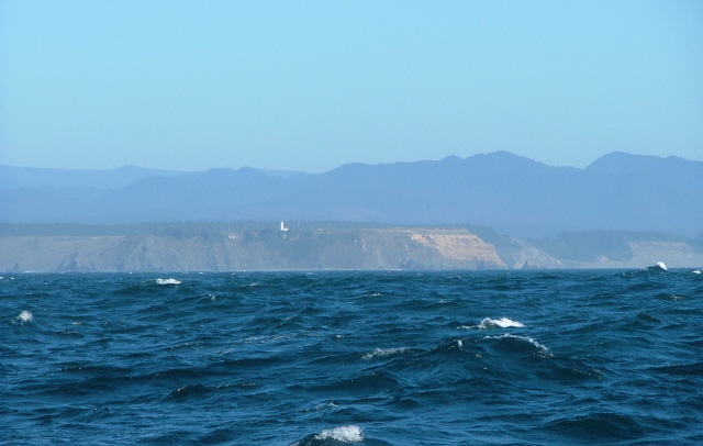
While not a particulary great photo, we include this shot of Heceta (heh-see-ta) Head because it was the only view we got of the coast from Newport to Winchester Bay. We had relatively dense fog and light winds for this "day hop". The photo also demonstrates how smooth the ocean can be when the winds are down. The photo fails to show, however, the three-foot swells that kept us rolling slightly, but not enough to be uncomfortable.
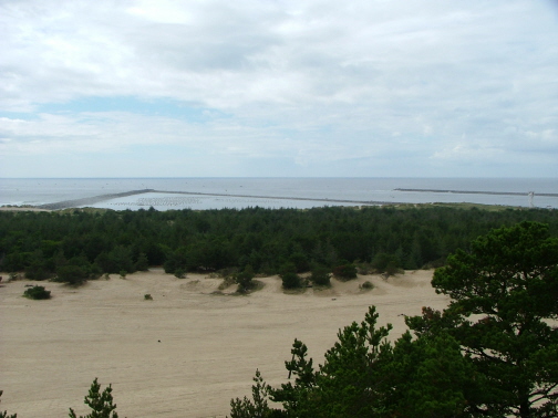
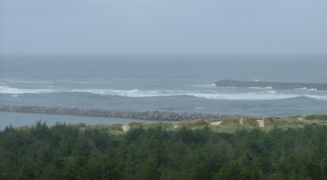
Beyond the dunes and pine trees are the three jetties that make up the entrance to the Umpqua River. This shot was taken the day after we arrived. Our transit of the river bar (just outside the jetties) was relatively easy, only moderate swells. However the fog was extremely dense and the radar screen showed over twenty contacts just inside the tips of the jetties, packed so close together it looked as though we'd have difficulty passing between them. However, we managed to dodge and weave our way through the small recreational fishing boats once they loomed out of the fog.
The triangle between the South and Training jetties contains commercial oyster beds.
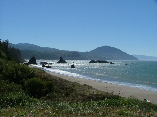
The beach in this area is part of the huge Dunes National Park that covers miles of beach between Florence and Coos Bay.
At the far right edge is the Coast Guard tower. Boats entering or departing can call the tower for a current report on bar conditions.
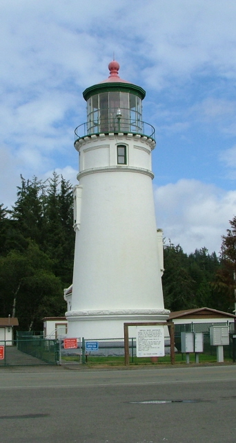
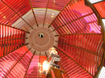
If one does an about-face from where the above picture was taken, you see before you the Umpqua River Lighthouse. We took the tour. It's a working lighthouse, although like most lighthouses today, the light is automated and there are no permanently assigned keepers. The tour is run by the Douglas County Parks division.
This light is somewhat unique according to our guide in that it is not only a red-and-white flashing light, it actually has a red lens, whereas other lighthouses with a red flash use a filter or some other device to create the red portion of the flash. It is difficult to make a red lens this size, partly because the substance required to make the glass red is gold. The photo below is a shot looking up into the lens with the active and spare bulbs in the lower foreground
There is also an amazing gift shop here that specializes in lighthouse souvenirs. It was huge and had everything imaginable to do with lighthouses: blankets, nightlights, lamps, etc., etc.
The bar wasn't quite so tranquil when it came time for us to leave. In fact, the first time we tried to leave we were met by the Coast Guard motor whaleboat and told that the bar was closed to all vessels. This shot was taken later that day, two days before we were able to leave. We still had breakers beside us all along the north side of the channel as we went out.
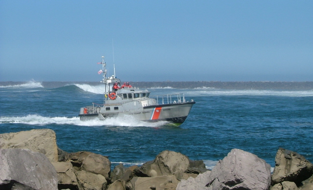
Here's the Umpqua River Coast Guard motor whaleboat patrolling the channel, preventing boats from attempting the bar.
The breakers along the north jetty were continuous all the way in to where the river turns north.
It's a big river. Amazing to think that the old lumber schooners used to sail in here before the jetties were built.
After we finally "escaped" from Winchester Bay and the Umpqua River, we turned south and had this nice view of the dunes from just a few miles offshore. For once we had enough wind to sail. However, it was not a steady wind. During the course of the day's run down to Port Orford, we had wind speeds from zero to 42 knots, and used various combinations of sail and engine power.
The 42 knot reading on our wind instrument came shortly after taking this shot of Cape Blanco, the very large headland that bulges out to the west on the southern Oregon coast.
Once we cleared the Cape and the many rocks and reefs to the west and south of it, we turned directly towards shore for the windy reach into the anchorage at Port Orford. This shot does not do justice to how windy it suddenly became. Kay was a real trooper as she hand-steered us the seven miles through gale force winds.
There is no marina in the traditional sense at Port Orford. The harbor is really just a south-facing cove protected from northerly winds by Cape Blanco and the Heads, a smaller headland just to the west. When the southerly storms of winter are raging there is no protection here. Consequently, the commercial and recreational boats that are home-ported here do not remain in the water and instead are hauled out by one of the three cranes seen here. Framed by them and in the distance, Kavenga sits anchored with 25 knots of wind still whistling through her rigging, whitecaps rolling on southward in the distance.
Our fiberglass dinghy can be seen tied to the float at the bottom of the long ramp on the right.
We were a little nervous about leaving Kavenga anchored in so much wind. If her anchor chain had broken she would have been on her way south without us.
Although the anchorage can be dicey at times, what a gorgeous spot. This beach seemed to go on for miles. The little town up on the hill is pretty laid back, with a couple of motels, B&Bs, and RV park. We did manage to find a Ray's Food Place at the far end of town and picked up a couple grocery items.
With no bar to cross we would recommend Port Orford as a good rest stop for any boats headed south along the coast--as long as the forecast is for wind and seas from the north!
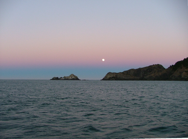
This "moonset" shot was taken looking west toward the Heads and Tichenor Rock that form the west side of the Port Orford anchorage. The wind blew at 20-plus knots the whole time we were there, which kept "Genny", our wind generator pumping amps into our batteries, hitting her max output of 30 amps at one point. All in all, a lovely anchorage, one that we would have liked to explore further, if we'd had the time and somewhat lighter winds in which to leave the boat.
We hoisted anchor and headed south early the next morning and crossed the latitude of 42 degrees north, putting us in the waters of California. Our time on the beautiful Oregon Coast was at an end.