BAJA, MEXICO
 Our 11-day stay in San Diego wasn't near
as hectic on this cruise as it was when we were here in 1990. We
didn't have the engine problems we had then and we weren't so new
to the whole process of preparing to leave the States for a
foreign country. Still there was plenty to do. We provisioned,
got our last series of shots, obtained our Mexican fishing
licenses and visas, and got the boat fueled and watered.
Our 11-day stay in San Diego wasn't near
as hectic on this cruise as it was when we were here in 1990. We
didn't have the engine problems we had then and we weren't so new
to the whole process of preparing to leave the States for a
foreign country. Still there was plenty to do. We provisioned,
got our last series of shots, obtained our Mexican fishing
licenses and visas, and got the boat fueled and watered.
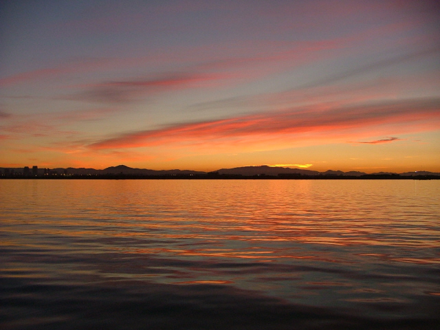
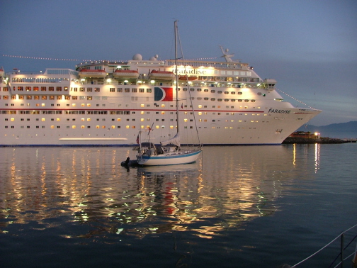
On November 17 we had no excuses for remaining in
San Diego and so at about 5:45AM we departed the Police Dock and
headed south out of the harbor and past Point Loma. The photo to
the right is looking east-southeast toward Tijuana, Mexico.
Our slip neighbor from Murphy's Landing in Gig
Harbor, Stan Brice on Mar Y Joe, was right behind us.
Having never gone through the process of clearing a vessel into a
foreign country, Stan wanted to tag along with us to Ensenada.
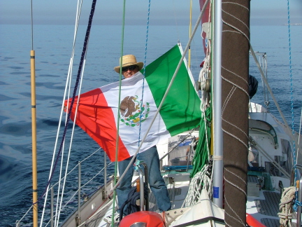
Once we crossed into the territorial waters of
Mexico, later that morning it was time to put up our Mexican
courtesy flag. Normally, courtesy flags are much smaller than
this, but we happened to pick this one up at, of all places, a
used book sale in a tent in the Safeway parking lot at Gig
Harbor.
It's only about 60 miles from San Diego to Ensenada and thus
we were able to arrive well before sunset. Upon entering the
harbor we could see the yacht anchorage area just beyond the
Cruiseport where the cruise ships dock.
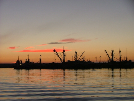
Having just had a great sunrise leaving San Diego, we were now
treated to a pretty sunset shortly after getting anchored in
Ensenada harbor. Here we're looking west toward the commercial
fishing vessels moored inside the jetty.
And right beside us to the south is the cruise ship dock with
another cruising boat anchored on the very edge of the small
vessel anchorage area. It was amazing to us how they could
maneuver these huge ships in such tight quarters without wiping
out those of us anchored so close by.
We stayed in Ensenada a little longer than we might otherwise
have due to weather and Steve's cold. We had a good time in
Ensenada, despite one cold and rainy day. We did some shopping
and had a fantastic dinner at the El Rey Sol restaurante. But
finally it was time to move on. Stan on Mar Y Joe was
still with us when we left, and we picked up another addition to
our little fleet, Beso, a Nordhavn 40 trawler-style
motor vessel. We first met Chip and Kay on Beso in
Marina Del Rey when we all happened to be staying at the Pacific
Mariner's Yacht Club.
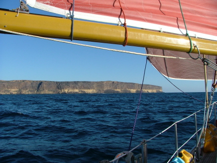
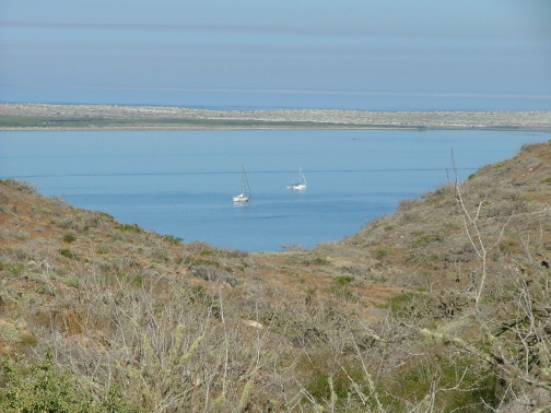
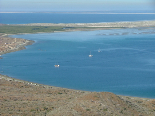
Kavenga was the vanguard of the "fleet" as
we approached Punta Colonet (or sometimes Colnett). If you looked
at it on a chart, the point looks for all the world like a human
nose jutting out into the Pacific. There's a semi-protected
anchorage on the other side that we are all headed for.
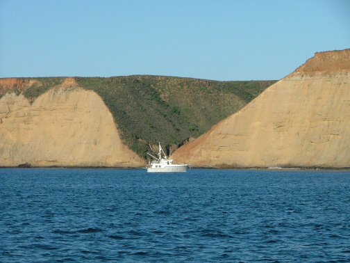
There's an arroyo on the south side of Punta Colonet exactly
where the nostril would be if the point were in fact a nose. It
is said that it is not a good idea to anchor directly south of
the "nostril" as the arroyo accentuates any wind coming
over the top of the mesa-like point. They say "when the
nostril sneezes, look out!" It looks as though Beso
is anchored in that spot, but in fact they are anchored much
further in our direction than it appears in this photo.
This shot was taken as we were leaving the following morning.
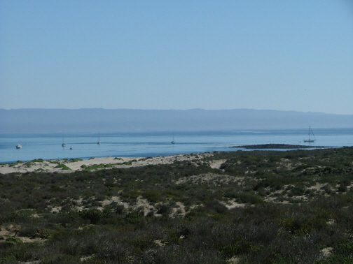
Our next stop was another "day-hop" south to a very
large open bay, somewhat like Drake's Bay north of San Francisco.
It's called Bahia San Quintin (pronounced "kin-teen").
Here Kavenga is on the far right. Beso is on
the far left.
When we briefly swung in here for a quick look in 1990 it was
blowing 25 to 30 knots and didn't look all that secure so we kept
going. In reality, as long as the winds don't come from the
south, it's a decent anchorage.
We had two peaceful night's anchorage here and, thanks to Kay,
a wonderful, traditional Thanksgiving dinner, for which Stan
joined us.
From where the above photo was taken, if you turn 90 degrees
to the left, you get this view of the entrance to the large
estuary at the head of Bahia San Quentin. Inside would be a more
protected anchorage. However, the channel leading in is a tad
shallow and always changing from season to season. The Mexican
government has talked of dredging and buoying it, but so far it's
just talk.
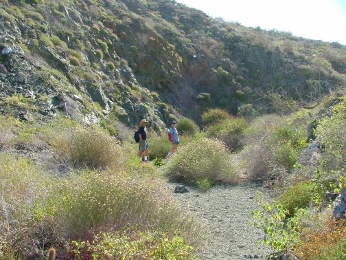
Eight miles up the estuary is the small village of Molino
Viejo (Old Mill) where we were given to understand there might be
a restaurant. We thought of trying it via dinghy but in the end
decided it was too long of a haul with too many things that could
go wrong.
"The Fleet" decided to stay in Bahia San Quentin
long enough to move to the other side of the bay and anchor off
the hotel beach. Here is Mar Y Joe following Beso.
San Quentin is a rather remote place, but they do have a
decent hotel and a motel/RV park. We heard there was a little
restaurant at the latter and braved the surf landing to check it
out. The surf wasn't as bad as it looked from the water side and
we all made it in without getting wet. We had a nice, typical
Mexican dinner at the Ceilito Lindo motel and RV park
and then braved the surf once again to get out to our respective
boats.
For the next leg we had planned another day-hop to a
semi-protected anchorage in the lee of Punto San Thomas. But when
we listened to our weather guru, Don Anderson, on the Amigos
cruiser's radio net in the morning, he was warning everyone of
very strong winds coming in 24 hours. Punto San Thomas offered us
very little protection if the winds clocked around to the west,
which eventually he said they would.
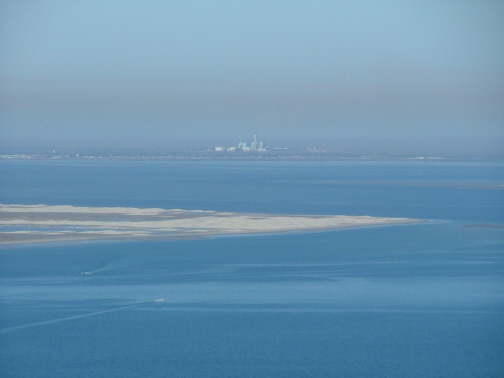
The next all-weather anchorage to the south was Turtle Bay.
All things considered we felt it best to make the longer,
overnight passage to Turtle Bay and arrive there ahead of the
coming gale, rather than have it catch us at Punto San Thomas or
enroute the next day to Turtle Bay. It was a good decision. In
this photo, we are anchored at Turtle Bay with 35 knot winds
sweeping the anchorage. Unfortunately they were also sweeping
yards of dust out of the hills and depositing it all over Kavenga
and the other anchored boats.
We were unable to leave Kavenga to go into town for a
day and a half due to the winds. This shot was taken just as the
winds had finally begun to abate and we soon caught a ride via
panga (open fishing launch) into town.
It hadn't changed much in 14 years. Still dusty and
downtrodden. If anything it's a little worse off than it was in
1990. Shortly thereafter the cannery had to close when the USA
quit importing Mexican tuna because it was deemed not
"dolphin safe". The population in Turtle Bay dropped
from 5,000 to 3,000 or less in a short time. It's over 100 miles
to the main highway and so doesn't have much going for it other
than being a great harbor. Perhaps investors will build a resort
and marina here some day. For now it's home to lobster fishermen
and a welcome refuge for pleasure boats headed north and south
along the rugged Baja coast.
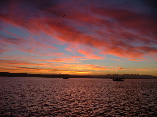
Once the wind died down we were treated to this beautiful
sunset over Turtle Bay.
 After quick stops at Asuncion and Abreojos, we made
a 135-mile overnight passage to Bahia Santa Maria, one of the
more popular stops for southbound cruisers. There are fishermen
to trade with for lobsters, fish, shrimp and abalone; beaches to
comb; surf to ride or run; mountains to hike; and mangrove
estuaries to explore.
After quick stops at Asuncion and Abreojos, we made
a 135-mile overnight passage to Bahia Santa Maria, one of the
more popular stops for southbound cruisers. There are fishermen
to trade with for lobsters, fish, shrimp and abalone; beaches to
comb; surf to ride or run; mountains to hike; and mangrove
estuaries to explore.
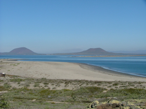
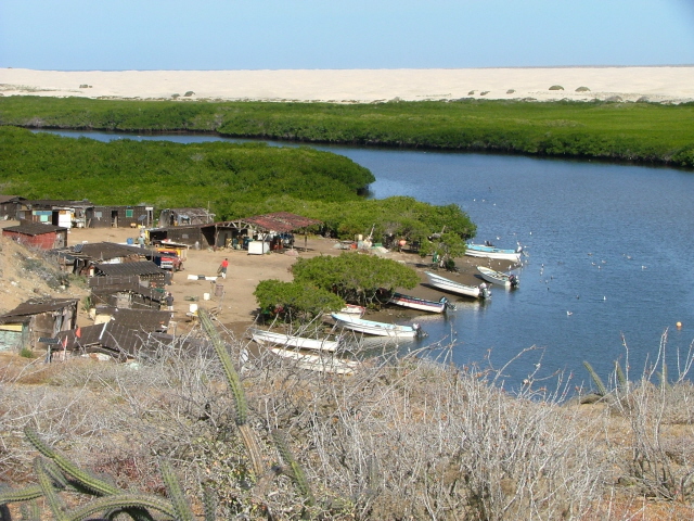
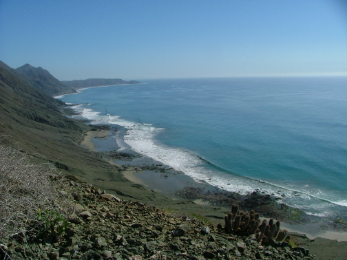
In this photo is one of three fish camps upstream on the
mangrove estuary that feeds into the head of the bay. The surf
often breaks all the way across the entrance so it makes for an
exciting dinghy transit from bay to estuary. This photo is
somewhat unusual in that it telescopes the varied terrain of the
surrounding area. Immediately in the foreground are cacti, common
to the dry hills and mountains surrounding the bay; in the middle
is the unique ecosystem of the mangrove estuary; and beyond are
the miles of dunes on the ribbon-like isthmus that separates
Bahia Santa Maria from the Pacific Ocean to the north.
The fish camp is typical of Baja. For the most part we're told
that these are not permanent homes. The fishermen and their
families come out and live here for the fishing season. The small
town of Puerto San Carlos is within reasonable distance via panga
for food and other necessities. Some of the more well-to-do
shacks had a solar panel and a TV dish antenna outside, so life
is not completely primitive here. Those are pangas lining the
shore.
We ran the surf in our dinghy at least three times to get into
the mangroves. On this day we were dropping off some second-hand
children's clothes to a couple of ladies in the camp. Along with
the Beso and Mar Y Joe crews we then beached
our dinghies and went for a hike to the Pacific side of the
isthmus.
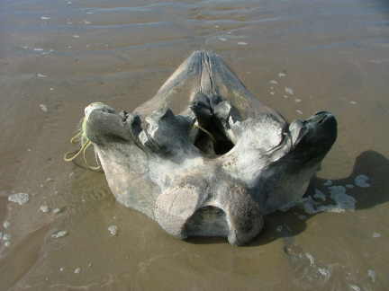
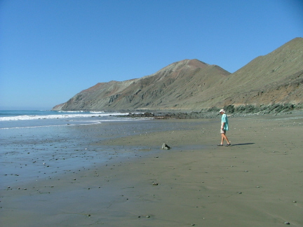
It took us less than an hour to hike to the beach. After
walking it for a time we felt like naming it Playa de Los
Muertos--"Beach of the Dead". We saw the remains of a
couple dead seals and dead turtles, and this 4-foot long whale
skull. It had some rope tied around it indicating past attempts
to drag or float it off the beach.
There are are also "skeletons" here of human
origin--ships. There are two shipwrecks on the beach. The one we
visited had been almost totally decomposed through the work of
rust and heavy surf.
Sadly, the beach is also littered with numerous plastic
containers that previously contained soft drinks or motor oil.
The weather during this period was very settled with
little or no wind most of the time, which made for comfortable
anchorages and a good night's sleep. Fortunately, when it was
time to move, it was just a 28-mile jaunt south to Bahia
Magdalena, so our pleasant days continued anew at this anchorage,
Man O War Cove at the northwest corner of this very large bay.
Like several of the large shallow bays and lagoons along the Baja
coast, Bahia Magdalena is a prime breeding and calving ground for
gray whales. We saw only one on the run down here but there are
more showing up every day according to reports from other boats
near the entrance where they congregate.
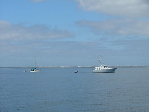
Here you see Kavenga and Mar Y Joe (Beso
had departed for Cabo San Lucas) lying peacefully in the windless
anchorage. The isthmus in the distance is all that separates
Bahia Magdalena from Bahia Santa Maria, from where we had just
come. The green strip in the isthmus is another mangrove estuary.
On the way down from Bahia Santa Maria we noticed a wild
looking ocean beach that would be approximately opposite our
planned anchorage at Man O War Cove. So after we got situated, we
found this arroyo which appeared to lead to a pass in the
mountains that we hoped would be above this same beach. This
arroyo, or dry creek bed turned out to be one of the highlights
of the hike. The fine-pebbled creekbed was like a superhighway
trail and was surrounded by a beautiful variety of plantlife.
Only near the summit of the pass were we forced to switch to a
nearby trail.
It was wonderful to break over the ridge and see that we had
all of this beach to explore.
Here's Stan, skipper of Mar Y Joe, on one of the two
huge beaches that the three of us had all to ourselves. We found
shells, sponges and interesting geology here.
Here's another shot of Man O War Cove and a piece of the
little town of Puerto Magdalena. Kavenga is anchored at
center, Mar Y Joe beyond and the junk-rigged Gia
(from Albany, Oregon?) in the foreground.
Here you get a better view of the extensive mangrove estuary
and neighboring Bahia Santa Maria in the background.
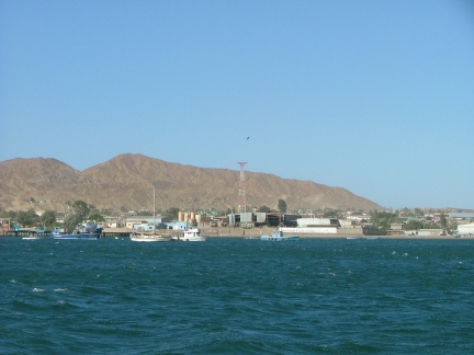
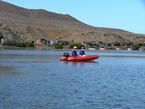
While anchored at Man O War Cove, we took a side trip via
panga to Puerto San Carlos, seen here in the distance.
When we were here in 1990 we took Kavenga up the zig-zagging
shallow channel and anchored in near the commercial wharf. This
time we felt it was worth the cost of a "water taxi" to
avoid having to anchor in the ship channel with its 2-knot
reversing current.
We had hoped to find a bank or ATM here, but had to settle for
just a lunch at the quaint Los Arcos seafood restaurant and a
stroll around the little town. In 1990 we were here for New
Year's Eve and the town was gaily decorated. This time it was
sadly rather drab.
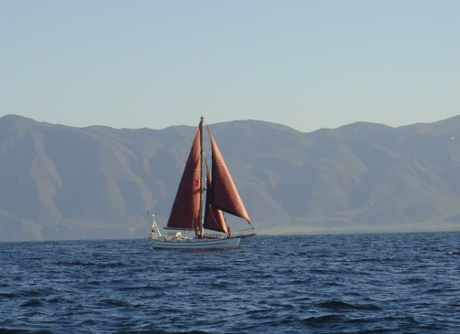
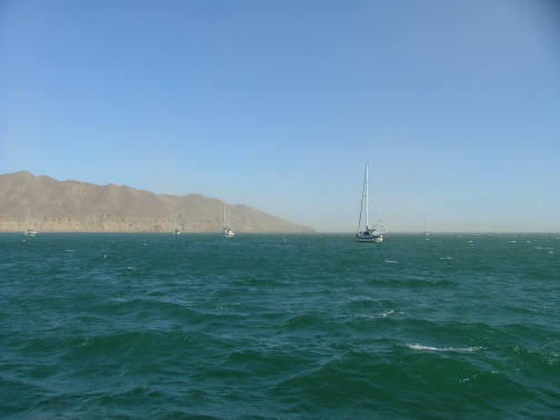
On our passage down the Baja coast it seemed as if we were
usually sitting out winds that were too strong in some harbor, or
motoring or motor-sailing in winds that were too light. Here's a
rare moment when we were sailing. Photo taken by Stan Brice.
This was quite different than our 1990 cruise when we had
moderate to strong winds a good deal of the trip.
Home